Approaching the future urban sky with the DELOREAN Project
The DELOREAN project, which stands for Drones and EGNSS for low airspace urban mobility, keeps developing with the real urban scenarios definition in Benidorm city.
The DELOREAN project was awarded by the GSA within the framework programme “EGNOS Adoption in Aviation” and its main objective is to develop innovative EGNOS based solutions that respond to the increased mobility needs of people and goods, enabling efficient, sustainable, affordable and effective air services in challenging urban scenarios.
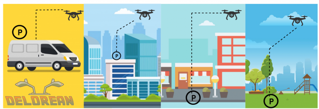
The two main points of the research, development and operational implementation of the project are UAM (Urban Air Mobility) and UAD (Urban Air Delivery). The project intends to demonstrate the benefits that air services would bring to both our present-day society and the future city sky by providing solutions and real alternatives to traffic congestion and offering more immediate solutions to our needs and desires. To do so, real flights will be performed in the city of Benidorm, through the use of EGNSS and intelligent systems for the safe navigation in the challenging urban scenario Benidorm offers.

Benidorm’s coastal urban area
The official start of the DELOREAN project took place last January 20th 2020 with the project’s kick-off meeting. Since then many advances have been accomplished: two CONOPS (Concept of Operations), one for each type of service, are being defined, the Urban Lab is also being characterized. The Urban Lab is the actual place where the scenarios are being outlined, it gathers all the necessary information such as the regulatory framework, or the technological aspects, that need to be taken into account. With all the previously mentioned documentation real urban scenarios will be able to be fully designed and ready for drones to fly through.
The consortium working behind this project is formed by CATEC, GeoNumerics, Airbus, Correos, Bauhaus Luftfahrt, Eurocontrol, UPV (Universitat Politècnica de València) and PildoLabs. Together, they intend to test, evaluate and quantify how distinguishing features of EGNOS and Galileo can contribute to the positioning and integrity requirements of such air services.
For more information on the project please check out the project’s webpage through the following link: https://sites.google.com/pildo.com/delorean